Press Release
 Scientists have collected samples and recorded data for the Coastal and Watershed Stabilisation project in Cane Garden Bay and Brewers Bay.
Environmental Officer (Climate Change), Angela Burnett Penn said through the Global Climate Change Alliance (GCCA) project, the Ministry of Natural Resources and Labour has begun the process to execute the pilot climate change adaptation project in the area. She said that in order to ensure the pilots are properly designed and engineered a hydrologic study of the watersheds and a coastal dynamics study of the bays are now being conducted.
Ms. Burnett Penn stated, “Those studies will help us to understand exactly what is happening in terms of rainfall events and the flow of storm water and flood water through the watersheds. On the coastal dynamic side we will understand wave energy and sand movements in the bays, including during swell events. The end goal of the project is really to design some solutions that will help to reduce flooding and sedimentation in both areas as well as protect the shoreline and rebuild the beaches.”
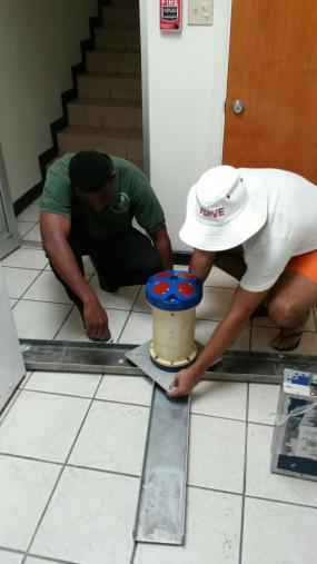
Hydroinformatics Engineer, Graham Jervis of Smith-Warner International, visited the Territory on March 7 through 10 to begin the initial sampling and data recording in the area. He was assisted by members of the Ministry of Natural Resources and Labour and Conservation and Fisheries Department.
Mr. Jervis explained that the data collection process began with sediment samples for a sieve analysis so as to understand the average grain size, which will be used in the sediment transport model.
He said, “We have also met up with a local surveyor to carry out beach profiles along Cane Garden Bay and Brewers Bay, which will be then tied into the previous bathymetric survey (which measures water depths) that was done for the tsunami project.”
The current profiles will be compared to historic aerial photos and past profiles to understand and quantify how the beaches have changed over time.
Mr. Jarvis added, “We are deploying two wave instruments to collect wave data for a period of one month in Cane Garden and Brewers Bay, (during the active swell periods) and we will be using that to verify our model. We have to make sure the model is making sense and then we can simulate with confidence the complex processes that occur along the shoreline.”
The project is being implemented under the umbrella of the European Union-funded Global Climate Change Alliance (GCCA) Project on Climate Change Adaptation (CCA) and Sustainable Land Management (SLM) in the Eastern Caribbean managed by the Organisation of Eastern Caribbean States (OECS). Under the GCCA Project each participating country has been allotted resources to design and implement physical adaptation pilot projects, which are on-the-ground projects that will help to reduce the impacts of climate change to local communities. This specific pilot project has a total value of 842,000 Euro (approximately $890,000).
Deputy Premier and Minister for Natural Resources and Labour, Dr. the Honourable Kedrick Pickering had announced the initiation of the North Shore Integrated Coastal and Watershed Stabilisation Project in the House of Assembly on January 25.
The Ministry of Natural Resources and Labour strives to effectively manage and administer the Territory’s Natural Resources in a manner that ensures long term sustainability.

